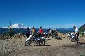
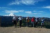
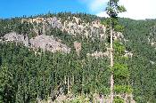
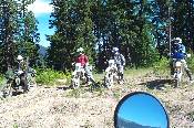
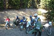
We started the day on FR7030, and at the T, went towards the right, and Naches. This is one of the first nice lookouts, with Mt. Rainier in the background. From left are Mike, Scott, Caleb, Rob, and Brians Arm.
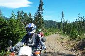
We are looking across FR1900 on the Naches side, to trail 945. I *think* that is Rob just getting onto the trail.
We took 945 to the first gravel road, and not knowing if there was another before the steep climb before Ravens Roost, took that to 963. This is just before coming out on the forest road that goes up to Ravens Roost.
Brian looking at Mike coming down the trail. Doug was behind Mike, bringing up the rear.
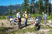
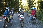
Rob, Brian, Scott, Caleb, Mike, and Doug, on Ravens Roost, with Rainier in the background. We met a guy here who was riding a pretty nice ATK, hopefully he'll show up on wa_dsr.
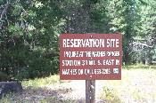
This is a reserve camp site that we are going to try and get into, and this was our only way of recording the phone number.
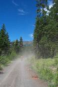
Riding up the road (1917?) in the general direction of Manastash ridge.
Doug, Scott, and Caleb at the junction of 1917 and 1901. This was our intended route to complete a loop coming out to the north, closer to our road to Green Pass. Problem was, our map was apparently outdated, and most of the jeep trails/roads on that map no longer existed. I had of course left two brand new Cle Elum Ranger District maps in the truck.
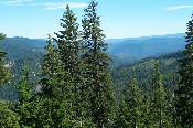
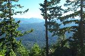
1901 wasn't where we should have been, but it did have some gorgeous views along the way. We're on one ridge, and this picture is looking east towards another (and doesn't do the area justice).
Mike and Caleb, wondering what I'm snapping pictures of.
Farther up 1901, this time looking towards the Kaner Flats / Crow Creek campground area.
I believe the common thought here was 'do we know where we are'? The road had gone from wide gravel to narrow, less used gravel, to red dirt, a wide spot with grass, and finally a wide spot with trees in it. At this point, the grass and trees were still to come.
Ah, we have grass and trees. The end of 1901. Game over. Finished. At this point, we were somewhere between trails 948 and 949, and we started to wonder if we could find one of those, instead of a lot of back tracking.
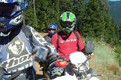
'We're lost? Hey, did I tell you the time about.....'
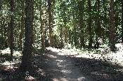
Brian and I found a spur off of 1901 that looked like it should cut into trail 948, and this view was our sole reward. The spur did in fact cross the trail, on the GPS, but not in reality. Later, after finding the real trail which had switchbacks cut into it, it looked like we couldn't have been 100yds from it at this point.
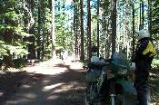
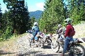
The top intersection of 948 and FR1904, just below a never ending section of switch backs. Rob and Brian, whom we had not ridden with before, were riding a pair of very large KLR650s, and making it look easy.
Another stop, another excuse for a picture. The older map didn't have 1904 on it, so we still weren't sure this was where we wanted to be. This was at the 2nd junction of 1904 and 948 (counting from the top).
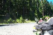
Last water stop, just off of 1900, heading towards Green Pass. The first picture of the day was the same location, looking the other direction towards trail 945.
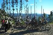
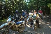
Our last picture of the day, and one that we seem to take every time we pass by here on the way home. At this point, the clock was ticking past 6:30pm, and we were definitely late getting home. From left, Caleb, Brian, Doug, Mike, Rob, and Scott.