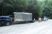
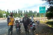
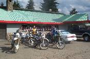
We were all a bit late this morning, and met Doug at the Greenwater Store. We followed him from there to our starting point on Rd 7030.
It may be hard to see, but there's a deer in the road on this picture. We waited a few minutes, and he didn't seem ready to leave the road. We started the bikes, and he walked up the bank on the right, and looked down on us as we rode by.
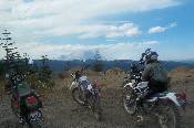
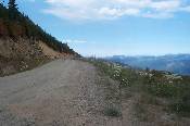
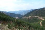
Our first sighting of Mt Rainier, on our way up Green Pass.
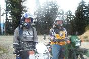
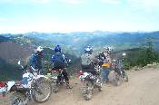
At the top of Green Pass, I got Mike and Scott to show their dirty mugs for the camera.
Looking north from the prior picture, towards Stampede and Tacoma passes.
The first switchback down the north side of Green Pass. When we were here on the prior ride, I could see nothing but cloud. Pictured are Doug, Rob, Mike, and Scott.
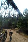
Rob stopped underneath a railroad tressel that leads into Lester, to explain a bit of history. The line was shut down for a few years in the early 90's due to a wash out, and was re-opened due to traffic demands.
Same spot, looking in a westerly direction, with Mike and Scott in the picture.
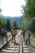
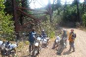
About a 1/4 mile up the road, and to the right on a spur road / trail, we were able to walk to the tracks. This is looking up the tracks towards Lester, with Mike, Scott, Rob, and Doug pictured.
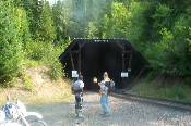
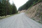
Up the road a bit, towards I-90, we came across a short tunnel. The light at the end of the tunnel is not a light, but the end of the tunnel. Look above the tunnel, and note there is nothing above it for quite a ways, makes you go hmmmm.
We saw a few more lookouts, and discoverred that the big tunnels are closed to public access due to security concerns (we're guessing). This is Doug and Rob coming up to I-90, Mike, Scott, and I had arrived a bit earlier by a more direct route (the road).
Same spot looking towards the highway, with Scott, Mike, and a road sign. From here we crossed the highway, and continued to Lake Kachees. We turned south at the lake, continued through a very nice neighborhood, down a jeep trail, and arrived at Easton for lunch.
Ah. Lunch.
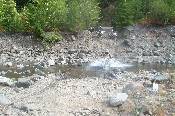
This is the river crossing, it is quite a bit lower than a few weeks prior, and will get lower yet without some rain. It has been unusually dry this summer, which makes for very dusty rides. This is Scott.
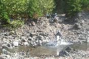
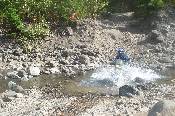
I made everyone take their turn through the water, hoping for some, ah, action. This is Mike entering the water.
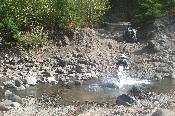
Doug is crossing as well, with Rob in the background looking on.
It looks like Rob is sinking, which is a possibility considering the size of his bike. The crossing here is actually very tame, with a smooth base, and no real boulders to contend with.
From the point where I took the pictures of the river crossings, this is looking at a bridge, wich *used* to be used for car traffic crossing here.
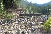
Looking in the opposite direction, down stream. This river runs through a narrow canyon, and it is very apparent that when the water is up, the canyon walls wash away. It looks like a permanent strip mining operation.
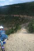
Riding back up Green Pass, near the end of our ride. Doug is on the left side, with Scott riding up the road towards us.
From the same spot, looking North again.
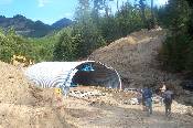
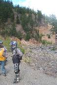
We passed the trucks coming back, and road to the end of Rd. 70 to look at the Culvert replacement project. On the last ride, the footings on either side of the culvert had been poured, but that was it. When done, it will come closer to where the guys are standing, and be filled in.
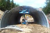
Rob inside, reaching for the sky.
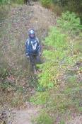
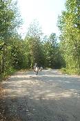
We found a trail. Ah, a shortcut, we thought. Well, it would have been at one time (at one time it was a road). The photo doesn't do it justice, but Rob's head is lower than my feet in this trench. We had to find a way around, to come across more obstacles like this.
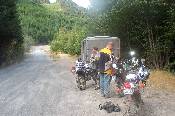
We are finally back at the truck, having had a good ride, but worn out.